

Wildfire Spreads In Three Ways
Creating defensible space and hardening your home helps protect you, your neighbor, and your neighborhood- the whole community becomes more resistant to wildfire.
The Fire Department wants all residents to understand the “why” behind the FireSafe Berkeley campaign. At the bottom of each page are recommended links for neighbors ready to take a deeper dive.

Ember Storm
Embers are small pieces of burning material that can travel more than a mile ahead of a wildfire. Embers can start spot fires when they land on combustible materials, such as leaves in your gutter or plants under your windows.
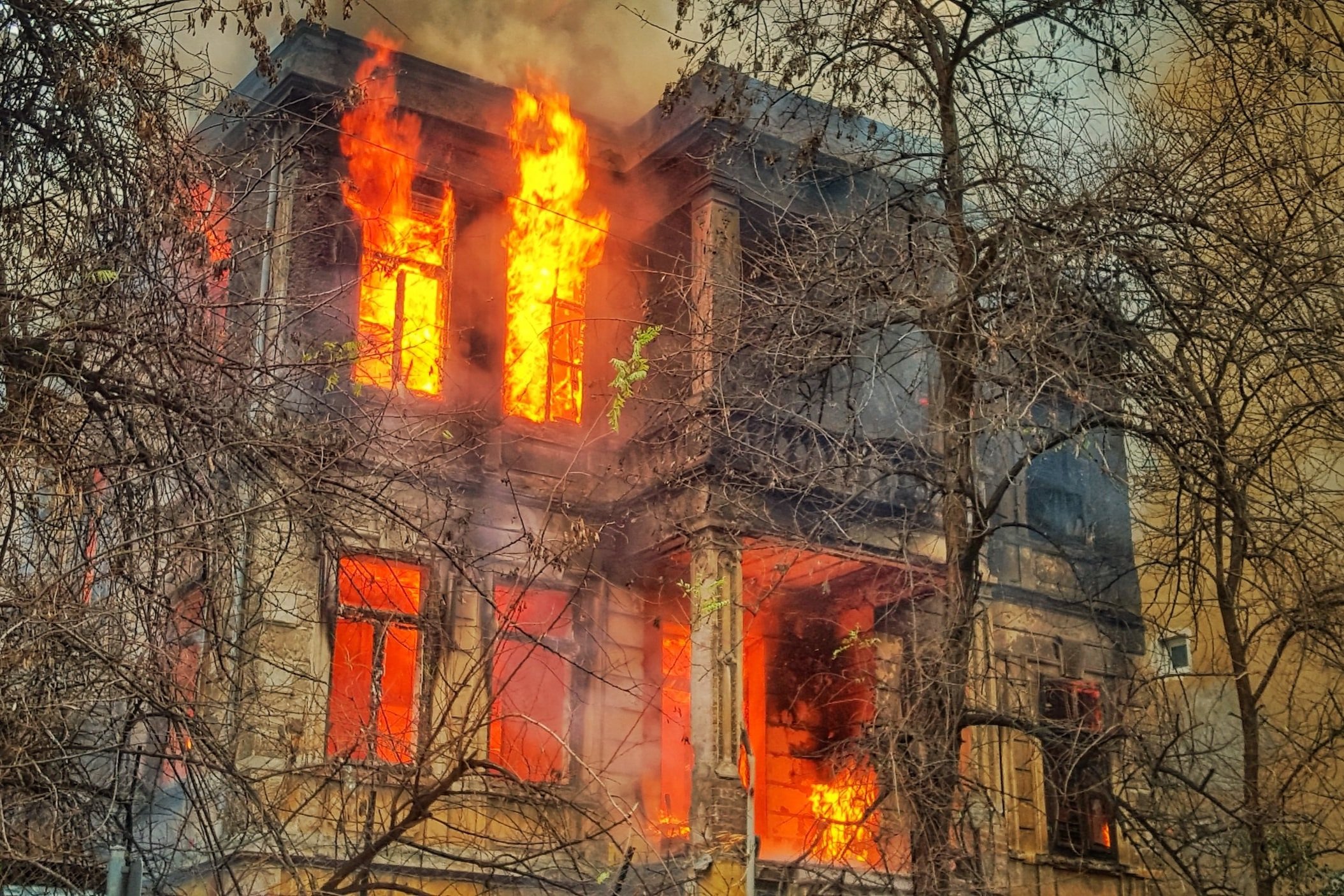
Radiant Heat
Radiant heat generated from burning fences, an adjacent home, or plants within 5’ feet of a home can ignite a house without flames ever making contact. This is particularly challenging in densely populated areas with structures positioned within 30 feet of one another, where the heat from one burning home can ignite the next.
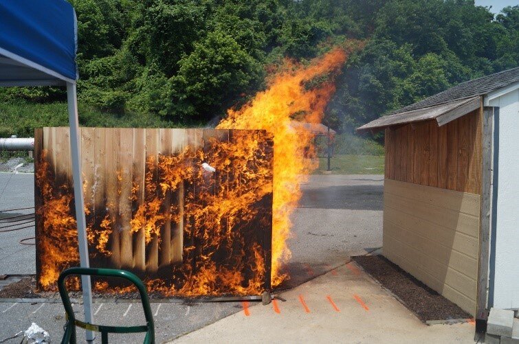
Direct Flame
While the flaming front of a wildfire is often not hot enough to ignite a house, plants or other combustibles within 5 feet can ignite a home by direct flame.
More Wildfire Spread Resources for a Deeper Dive
-
The link to the recent webinar, “It will happen here again: Reflecting on the LA fires and what it means for the BayArea fire prevention” on January 23, 2025, was hosted by The Bill Lane Center for the American West
The Widland Fire Seminar series page can be found here
-
The goal of this Camp Fire case study is to learn and increase preparedness for future incidents. This study focuses on the life safety aspects of the Camp Fire incident: notification, evacuation, traffic, temporary refuge areas, rescues, and fatalities. A total of 31 temporary refuge areas were implemented during the incident, involving more than 1200 civilians. Further, 198 specific evacuation assistance / rescue events were identified, involving at least 1000 civilians.
-
The purpose of this report is to use the lessons learned from the NIST Camp Fire case study to present a methodology and other considerations about WUI fire incidents that can be used by small and intermediate-sized WUI communities to help develop notification and evacuation plans.
-
A CWPP is a strategic plan typically developed by a local fire department, federal and state land managers, local governments, and communities. The CWPP will provide a roadmap to mitigate the risks posed by wildfires including goals for improving wildfire response, community preparedness, fuel management, infrastructure, ignition reduction, home hardening, and more. Input from the public and other stakeholders will help inform priorities.
-
During a bushfire, embers will reach your home long before the flames do. Ember attacks are the most common way that houses catch fire.
This short animation explains what embers are and how they can travel long distances to continue and start new fires.
You will get a sense for what it feels like to be caught in an ember attack and understand some of the reasons fire services recommend that you leave a wildfire risk area early, before a fire starts.
Leaving early is always your safest option.
-
Structural losses in wildfires have been attributed to exposures from embers (firebrands) and fire (radiation and/or convection). As structural losses continue to increase, there is need for a comprehensive hazard assessment and mitigation methodology to harden appropriate structures and parcels effectively and efficiently against ember and fire exposures.
The science-based methodology in this report uses the knowledge collected from post-fire field observations spanning over a dozen years and tens of thousands of hours of field data integration and analysis, and utilizes the latest technical knowledge gained from laboratory and large-scale research in fire propagation and hazard mitigation in the WUI.
The study is the result of a sixteen-month collaborative effort between NIST, the California Department of Forestry and Fire Protection (CAL FIRE), and the Insurance Institute for Business and Home Safety (IBHS).
-
This news story gives us insight into what lessons we can learn to prevent a disaster like the 2018 Butte County wildfire. “On a brisk November morning in 2018, a fire sparked in a remote stretch of canyon in Butte County, California, a region nestled against the western slopes of the Sierra Nevada mountains. Fueled by a sea of tinder created by drought, and propelled by powerful gusts, the flames grew and traveled rapidly. In less than 24 hours, the fire had swept through the town of Paradise and other communities, leaving a charred ruin in its wake.